Tip Toe Mountain Preserve

Size: 40 acres
Be Aware:
Foot traffic only. Please do not hike on the right-of-way to the private residence (see map).
Please stay on trails, especially at the summits. These all have near-vertical drop-offs, so please watch children closely.
The existing traditional access to Big Tip Toe is a short, steep scramble up over bare ledges. This is very challenging terrain, especially when wet. Please use good judgment and caution before attempting this.
The stone dam crossing on the Shore Trail is submerged for roughly an hour on either side of high tide; hikers should utilize the Loop Trail when the tide is high.
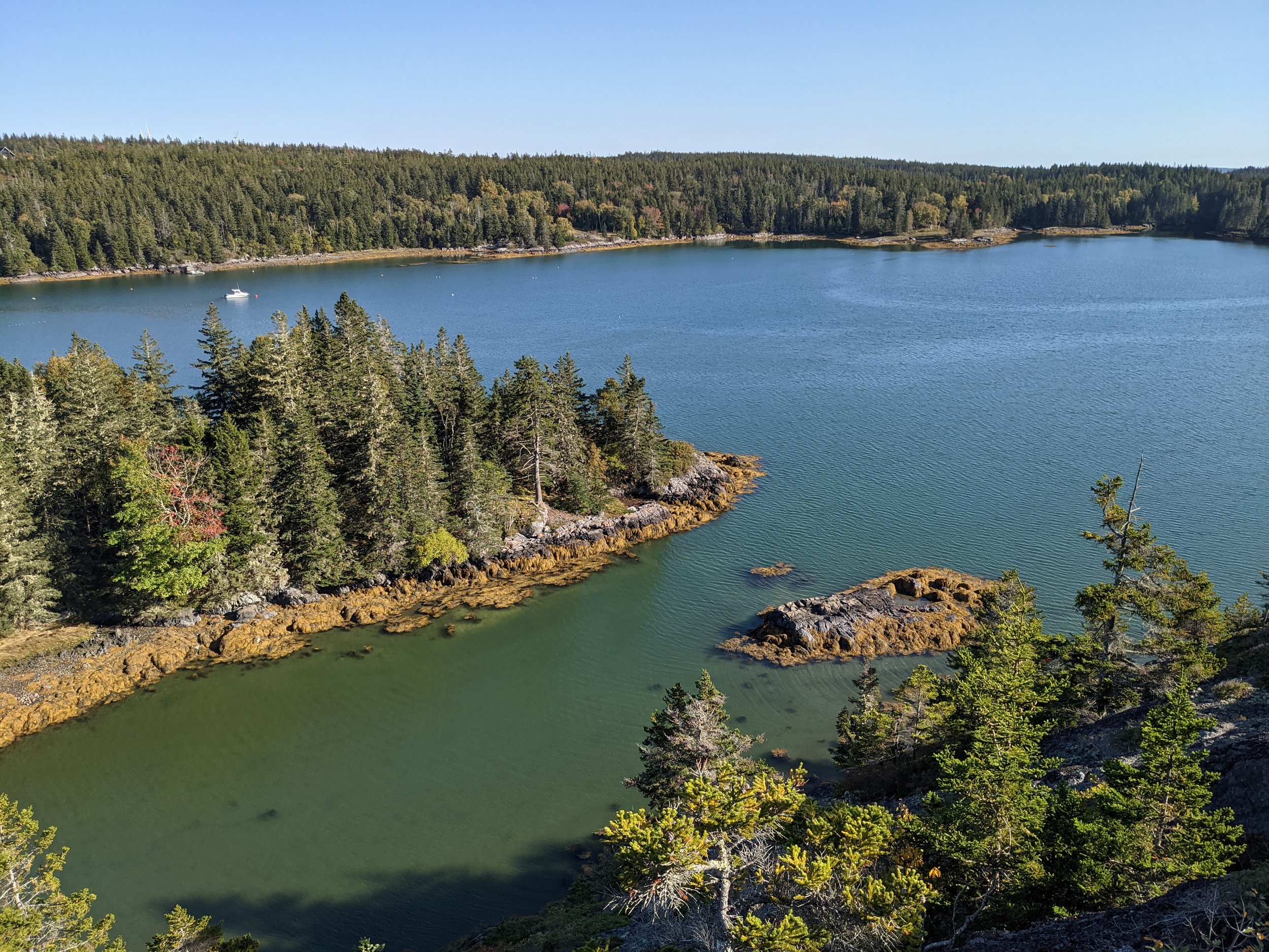
Features: Multiple panoramic views of islands and ocean, from the northwest all the way around to the east, interesting bedrock geology; walkable shoreline; and very high biodiversity in a small area. Short new trails were cut in 2018 that provide safer access to the summits of both Little and Big Tip Toe Mountains.
Directions: Turn left from the ferry terminal, go 0.4 miles, then right on Old Harbor Rd for 0.3 miles. Bear left onto North Haven Road for about 6.5 miles to where Tip Toe Mountain Road (gravel) will be a left turn. Drive 1.2 miles, the gravel parking lot at the base of Little Tip Toe Mountain Town Park will be on your left. A nearby kiosk marks the Middle Tip Toe Loop trailhead.
Trails:
Middle Tip Toe Loop – 0.5 miles, mostly shady and with easy grades for all hiking abilities.
Shore Trail – 0.3 miles from near the base of Big Tip Toe to the stone dam crossing at the head of Marsh Cove.
Big Tip Toe Mountain – A short climb from the head of the Gorge.
Loop Trail – 0.3 miles long, allowing shore access at all tides

Bench at Big Tip Toe overlooking Camden Hills, photo by Sheri Romer.
History
Any discussion of these high lands on Crockett Point has to begin with their turbulent geologic history. At least three different sequences of volcanic activity in the Devonian period (about 360 million years ago) caused multiple lava flows and earthquakes. In fact, the section that we call “the Gorge” is actually a fault line, where the earth’s crust obligingly parted just enough to fit today’s Tip Toe Mountain Road in the resulting gap.
In human history, the geology continued to play a part. Native Americans collected rock from the shore here to shape into projectile points, and the very name “Tip Toe Mountain” is said to refer to the Wabanaki people using the mountain as a place to keep a stealthy eye on colonial boat traffic in times of simmering tensions. Today the site is covered by a mature spruce/fir forest, but an 1858 map shows a mix of forest and pastureland here. The trail to the shore crosses the remnants of a stone-and-timber dam, probably built by Colonial-era farmers to create salt marsh pasture for their livestock.
When the so-called “Big Tip Toe” parcel came on the market, both Vinalhaven Land Trust and Maine Coast Heritage Trust took immediate notice. Ultimately it was decided that VLT would buy the land, with MCHT helping greatly with technical arrangements and fund raising. The Tip Toe acquisition became the centerpiece of VLT’s recent 25th Anniversary Campaign, and with the help of many generous supporters we were able to close on the property in September of 2013.

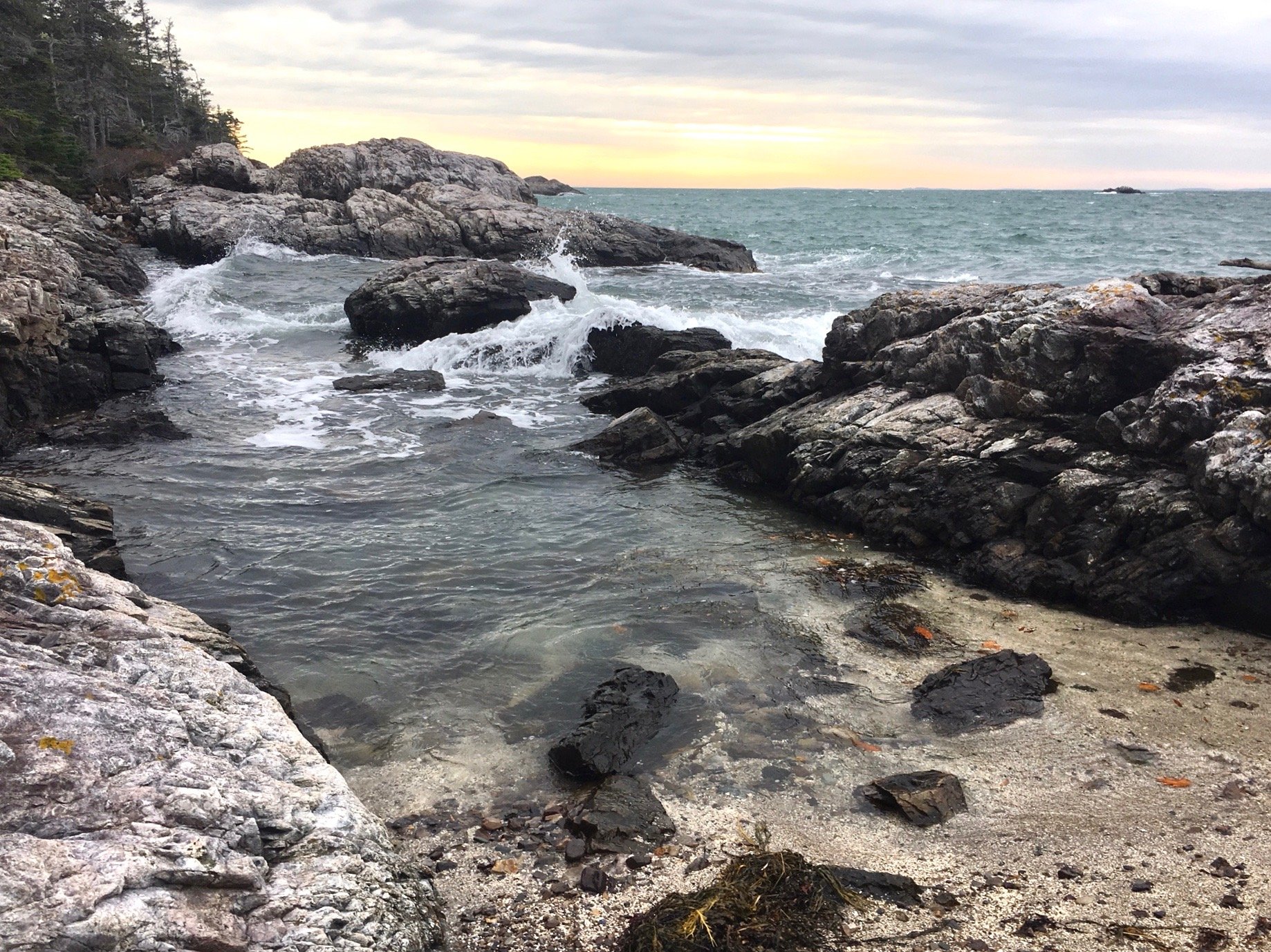
Tip Toe beach, photo by Banner Moffat.
Natural Resources
Forty acres doesn’t sound very big, but when you consider that it contains rocky summits, islands, salt marshes, forests, wetlands, vernal pools, and over a mile of shoreline, you realize that Tip Toe offers a lot of habitat in a little area. Everything from rare lichens to river otters finds a home here, and in early fall visitors are sometimes treated to the sight of dozens or even hundreds of hawks “kettling”— circling in the updrafts to gain elevation above the summit called Big Tip Toe.
Islanders have long scrambled up short, steep trails to two well-known summits here for the sweeping panoramas they offer: Big Tip Toe, which overlooks the Fox Island Thorofare, West Penobscot Bay, and the Camden Hills; and Little Tip Toe, belonging to the Town of Vinalhaven, overlooking Crockett’s Cove. Between these two promontories lies even higher land on Middle Tip Toe, and in 2014 VLT created a loop trail here to provide easier hiking access to several more outstanding overlooks. Additionally, another short trail leads to the western shore, where beachcombers and rock-hoppers can enjoys hours of entertainment.