Environmental News

Barton’s Quarry, photo by Kerry Hardy.

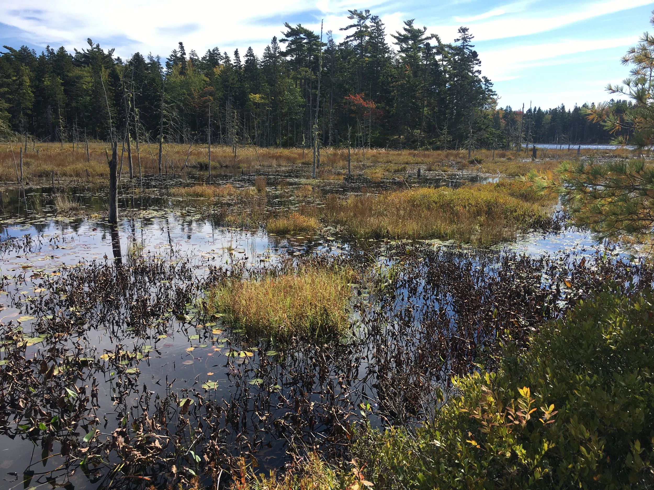
Overlook Trail at the Lower Mill River Preserve, photo by Kerry Hardy.
2021 New Land Protection on Vinalhaven
2020 was a banner year for land protection!
Thanks to our generous donors, VLT was given three parcels of land in 2020.
We featured Little Garden Island in our fall 2020 newsletter. This rocky 5.4-acre island in the White Island group in western Penobscot Bay was donated to us last March by our partners at Maine Coast Heritage Trust. As this island hosts an active heronry (heron nesting site), public access will be limited to outside of nesting season. To learn more about Little Garden, you can find our fall newsletter on our website under the “News” menu.
‘Connectivity’ is a word we often use when thinking about conservation priorities. Land trusts look for connectivity in the lands we protect as we seek to create larger areas of undeveloped habitat and corridors so wildlife can move safely between those larger blocks. We also look for options to connect our trails, providing hikers with opportunities for longer hikes through varied terrains, something that is often requested.
Early in 2017, Kerry Hardy, VLT’s stewardship coordinator, and I were looking at our map of protected properties on Vinalhaven with connectivity in mind. We were intrigued by the possibility of a trail from Round Pond on the North Haven Road to Maine Coast Heritage Trust’s Carrying Place Bridge Preserve on Calderwood Neck. Such a trail would start on the Round Pond Preserve, protected by an easement held by VLT, and run through other land also protected by an easement held by VLT. However, there was a privately owned 34-acre parcel that needed to be crossed in order to reach VLT’s Fish Hook Preserve. From there, one could hike down to the eastern edge of that preserve and across the street to the Carrying Place Preserve.
We knew the owner of that 34-acre parcel, Charlie Sullivan, who had given us the first, cornerstone parcel of what is now the Fish Hook Preserve in 2006. We wrote him, asking if he might be willing to grant us a trail easement across his land. Imagine our delight when he responded that he would like to come meet with us in early summer to walk a possible trail and explore options for the property. It had been thirty-four years since Charlie and his wife, Susan Maycock, had last been to the island; we looked forward to giving them the tour.
With their permission, Kerry and I started exploring the property to site a possible trail—and were blown away by how beautiful and varied it is. There are high bare ledges, separated by hardwood seeps that contain some of the largest red maples and yellow birches on Vinalhaven, and over 2,500 feet of frontage on Mill River. An area, still regenerating from the fires of 1933, boasts an expansive fern and birch meadow. Intriguing rocks sport toupees of naturally dwarfed balsam fir; the rocky curves of glacial erratics are softened by mosses and lichens. I confessed to Kerry that I felt this was a parcel very worthy of permanent protection, due not only to its location, but also to its varied habitats and topography that will provide climate resilience for both plants and animals as our climate changes.
Like so many conservation projects, this one proceeded slowly over the next few years, as Charlie and I explored options to help him achieve his goals for the property. The project went through several iterations, which was not unusual as landowners contemplate the legal, financial, and possible estate ramifications of conserving the land that they love. Fast forward to the fall of 2020, when Charlie announced that he would like to donate the property to VLT before the close of the year!
A new loop trail should be available for hiking by late spring, accessed from the Fish Hook trailhead on the north side of the Calderwood Neck Road. The trail all the way to Round Pond will take longer to develop, as other landowners will be involved.
If the project to create what is now VLT’s Overlook lot was a long slow waltz, our final 2020 project was a fast-paced tango. In May, VLT was contacted by Basin Land Trust (BLT), asking if we would be interested in owning their 24-acre parcel to the north of the Basin entrance, as the trust was terminating in late October, per its incorporating documents. In 1989, BLT had granted a conservation easement to VLT on this parcel, with Maine Coast Heritage Trust as “backup” easement holder. Other VLT monitors had been making annual visits to this site, but Kerry and I had never personally explored this parcel before—so we headed out again, and encountered yet another wonderful landscape. Exploring a fern meadow near the shore, we discovered several rhubarb plants, likely indicators of an early settler; old quarry works provide another clue to this parcel’s past. High ledges offer a breathtaking view over Hurricane Sound. Basin Land Trust had long referred to this parcel as the “Barton’s Quarry Lot”, as Muriel Perkins purchased it from the four Barton siblings back in 1939. VLT will be retaining that name for this parcel. It will be managed under the terms of the Basin Management Plan, a joint project of VLT and MCHT that provides consistent and informed management guidance for all the conserved lands surrounding the Basin.
With many thanks to the trustees and shareholders of the Basin Land Trust, this parcel was gifted to VLT at the end of December 2020.
Given that access to this parcel is on the Hurricane Sound side, by small boat only, and that VLT needs to be very mindful of respecting the privacy of our abutters, this preserve may not be open to the public until later in 2021.
The board and staff of VLT are incredibly grateful to these generous donors, who have entrusted their land to our care in perpetuity. We are honored by their generosity, and look forward to sharing these special places with you.
~Linnell Mather

Little Garden Island
Spring 2020
Little Garden Island, located in the middle of the White Islands, a couple of miles west of Vinalhaven, comprises roughly five acres of granite ledges, spruce trees, and great views. Not much changes there from one year to the next—but in 2019, change came in a big way.
First, and for reasons best known only to themselves, some great blue herons decided to establish a nesting colony there. This is not an everyday event; heronries tend to be long-term communities once established. The State of Maine only counted two in all of Penobscot Bay in its 1987 management plan, so to have a new one established is a big deal. The herons, perhaps two dozen in number, were not deterred by the active osprey nests already there; in fact, some of the biologists at Maine’s Department of Inland Fisheries and Wildlife (MDIF&W) are of the opinion that the herons and ospreys benefit from each other’s presence as a defense against bald eagles stealing their nestlings.
Simultaneously, and with no awareness of the developing heronry, discussions had begun between the island’s owner, James Gaston, and Maine Coast Heritage Trust about the possibility of MCHT acquiring the island for conservation purposes via a bargain sale. Bald Island, Big Garden, Big White, and Little White Islands are already protected through ownership by or conservation easements granted over the years to the Nature Conservancy, MCHT, and VLT.
With this unfolding dialogue as a background, VLT decided to visit the island in May of 2019— and found, to our surprise, a LOT of great blue herons raising a fuss about being visited. We quickly backed away, and passed the word to MCHT that the island’s conservation values might be increasing.
The combination of a bargain sale offer and the emerging heronry made the island an attractive acquisition, and by year’s end MCHT had closed on the property. (A bargain sale occurs when a property is offered for sale to a conservation organization at less than appraised value. The seller may be eligible for a charitable tax deduction for the difference between selling price and appraised value.) Discussions between MCHT and VLT had continued over the winter, and at the January meeting of VLT’s Board of Directors, the board voted to accept MCHT’s offer to transfer the island to VLT’s ownership.
Knowing VLT’s proven track record of strong stewardship, MCHT knew the island would be in good hands. This transaction was completed in late March. We will now begin developing a management plan for the island, with particularly close attention being paid to whether the herons return, perhaps in even greater numbers, in the spring of 2020. If they do, then we will be limiting access to the island for the full extent of their nesting season, and even urging people in boats to stay an appropriate distance away at all times.
As the bald eagle population has increased in recent years, the populations of their preferred prey species (cormorants, loons, herons, and bitterns) have come under increasing pressure, making it all the more important to protect the places where those species nest. If great blue herons can succeed in establishing and protecting a breeding colony here, it will be an important new component in the local ecosystem…and a great reason for bringing Little Garden Island under conservation stewardship. As with all of our properties, VLT will make an annual payment in lieu of taxes (PILOT) to the town of Vinalhaven—making this a win-win proposition for all of us.
Linnell Mather, VLT’s Executive Director reports: “MCHT has been a strong and supportive partner of VLT’s from our very beginnings as a land trust. We are incredibly grateful for all they do for us, from helpful guidance on land protection and stewardship to generous donations such as this one. Thank you, MCHT!

New Trails in 2020
Spring 2020
Hikers looking for a change of pace will have a couple of new trail sections to explore on the island this year.
The first is at VLT’s Fish Hook Preserve on the Calderwood Neck Road, where a 0.2-mile extension allows hikers to walk almost all the way down to the nearby MCHT Carrying Place Bridge Preserve to connect with that trail. The new trail traverses a dramatic side hill underneath mature evergreens, bringing hikers out to a wooden bench sitting atop an impressive bank of granite ledges and boulders. The bench makes a great place to sit quietly and watch for ducks, eagles, and ospreys, or to just enjoy a scenic look back at Fish Hook and the surrounding waters. There are no especially big hills on the trail, but it’s still a good place to hike with a walking stick.
The other new trail offers a quick trip back in time. Hikers can park right at the gravel pull-out next to Round Pond, and will find the new trailhead directly adjacent. It follows an old road right-of-way, from when North Haven Road was farther back in the woods, away from the edge of Round Pond. A short 0.1-mile walk brings you out onto the high ledges overlooking Round Pond, where a rustic bench invites you to sit and enjoy the view. This trail is short and easy enough for hikers of all ages, and one of its many attractions is the contorted red maple tree that arches completely over the path.
Alternatively, you can choose a left turn in the trail that will take you up through mature spruces and massive granite blocks and ledges, ultimately connecting to the existing network of trails already established on this property. This branch of the trail is also only 0.1 miles in length, of which the first 200’ are fairly steep—again, a good place for a walking stick.

Alewives to Old Harbor Pond
May 2019
The Maine Department of Marine Resources have brought the third batch of mature alewives to rebuild the spawning run on Vinalhaven. Dropped into Old Harbor Pond in late May, these adult fish will quickly spawn in the shallows before heading back out to sea. Their juveniles will stick around until August, when they will have grown large enough to start their own four-year odyssey through the ocean, before returning once more to repeat the spawning cycle on Vinalhaven.
Keep an eye on the pond this summer for some great wildlife activity. While they spawn, you'll see the water boil with moving fish, a sure sign that otters, loons, cormorants, ospreys, herons, and eagles will be dropping in for a snack.

New Land Protection
Spring 2019
VLT is pleased to report that we completed two new land protection projects in 2018.
First, in late October, Jean Scudder donated two parcels of land to VLT. Though small, just over five acres in total, these are the last two undeveloped, unprotected parcels with frontage on the Basin. The smaller parcel shares a boundary with VLT’s Kintner Marsh Preserve and contains significant salt marsh, as well as a small “island” of higher ground, covered with spruce of varied ages and health, as well as a well-established stand of poison ivy. A small area of this parcel has been traditionally used by a local lobsterman for off-season storage of the traps he fishes in the Basin; VLT has negotiated an agreement with him that will allow him to continue to do so for as long as the traps are actively fished.
The other parcel is very low and wet, with vegetation that is mostly alder and other wetland indicator species, with some spruce. It has a slightly bolder, wooded shoreline that looks across a small inlet to property donated by Ms. Scudder to Maine Coast Heritage Trust in 2007.
Writes VLT Stewardship Coordinator Kerry Hardy:
“Eagles, ospreys, wading birds, gulls, seals, deer, raccoons, and mink, along with a host of smaller creatures that populate the water’s edge, are just some of the animals known to use these properties. Likewise, the relatively large expanse of salt marsh on the northern parcel is a valuable natural resource, and should be protected to the extent we are able. Sadly, we acknowledge that changing sea levels will greatly impact both of these sites, especially the northernmost. Salt marsh erosion, specifically the slumping off of large shelves of soil, is already very noticeable here. At king tides, the salt marsh is often largely inundated.”
With a combined shoreline of about three-eighths of a mile, there is significant trash along the shore of both parcels, the clean-up of which will be on the schedule for this summer. Let us know if you are interested in volunteering to help with this effort! VLT’s stewardship staff and committee will be spending more time on this property during 2019, as we add to the existing management plan to determine how best it can serve our community, while also adding to the Whole Place conservation of the Basin that VLT and our partner, Maine Coast Heritage Trust, have been working towards for many years.
We are very grateful to Ms. Scudder for this generous gift. She is responsible for much of the land protection that has already occurred around the Basin. In addition to the property donated to MCHT mentioned above, she also donated the 83-acre Watershed Preserve to VLT in 2003, protecting in perpetuity 64 acres in the watershed of the Vinalhaven Water District.
Secondly, also in 2018, VLT completed its first modified agricultural easement on land owned by Laura Blankertz, protecting approximately 34 acres of land on Calderwood Neck. The protected area has approximately twelve acres of mowed fields ad over six hundred feet of frontage on Carver Cove, in addition to a moderately sized wetland that extends into the southwest corner of the property. According to the 2002 map prepared for Vinalhaven Land Trust by College of the Atlantic, most, if not all, of the soil in the area protected by the easement is Peru Fine Sandy Loam 3-8% slope, which is excellent for farming. The easement allows for a wide range of agricultural activities on the property, including the growing of crops for sale or for livestock feed, grazing of animals, Christmas tree farming, or the production of nuts, berries, or flowers. The easement ensures that the modest farm house and barn will maintain their current footprints, and that the fields that sweep down towards the shore and woodland are available for farming, grazing, and small-scale forestry in perpetuity.
The property is the former home of the Clint Calderwood Dairy Farm, which produced and sold milk until 1946, when the farm was sold to seasonal residents. A picture from that period shows the house and barn looking very similar to their appearance today, as well as a carriage house or small barn in an area where the easement will allow for the construction of “agricultural structures” such as a barn, milking or hay storage sheds or cheese-making facilities. More recently, about two acres of the lower fields were used by Sparkplug Farm for growing some mid-season crops as the soil in that area held moisture well, allowing the crops to grow better during the hottest part of the summer. With the growing focus on supporting locally grown food, and the very few areas on Vinalhaven with soils this highly rated, the VLT board felt a conservation easement that would prevent the subdivision and possible development of this former active farm was the right thing to do.
Through their generosity, Jean Scudder and Laura Blankertz have helped conserve the nature of Vinalhaven. These were two very different projects: one helping to complete the protection of a Whole Place focus area, the other making sure that good farmland is not lost to development and will remain available for agricultural activities. Thank you, Jean and Laura!
~Linnell Mather