Lower Mill River Preserve
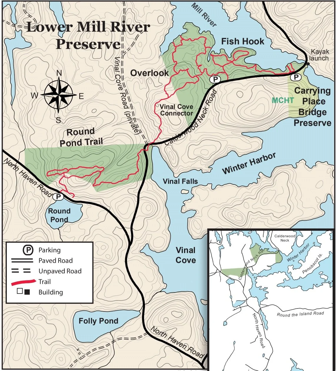
Fish Hook/Round Pond/Carrying Place Bridge Brochure
Fish Hook Trails
Size: 15 acres.
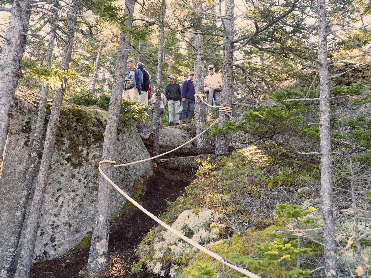
Trail: 0.6 miles round trip, moderate difficulty. As you hike down the first hill here, you’ll see a trail branching to the left which leads to a map kiosk. From here, the trail continues to follow the shore all the way through our Fish Hook Preserve, offering several panoramic views from rocky overlooks, benches in these spots allow hikers to relax and enjoy the scenery, and the shallow bay and coves surrounding the Fish Hook peninsula usually offer glimpses of ducks, herons, osprey, and eagles. Though the grades are easy, this half-mile long trail crosses a few ledgy spots where hikers will want to pay closer attention to their steps. The trail brings hikers out on the Calderwood Neck Rd. about a quarter-mile from the parking lot, and very close to the Carrying Place Bridge—where more trails await.
Overlook Trails
Size: 34 acres.
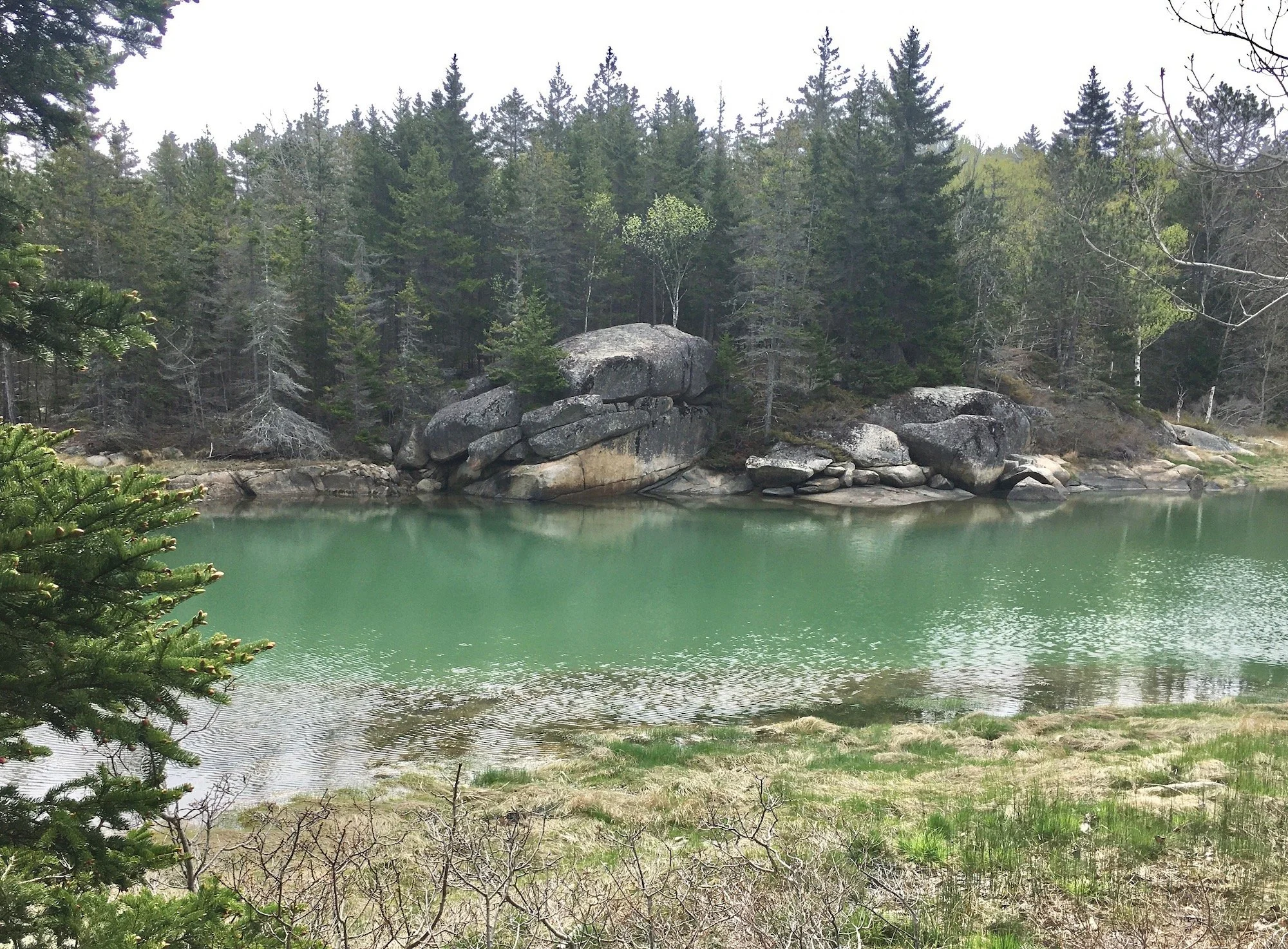
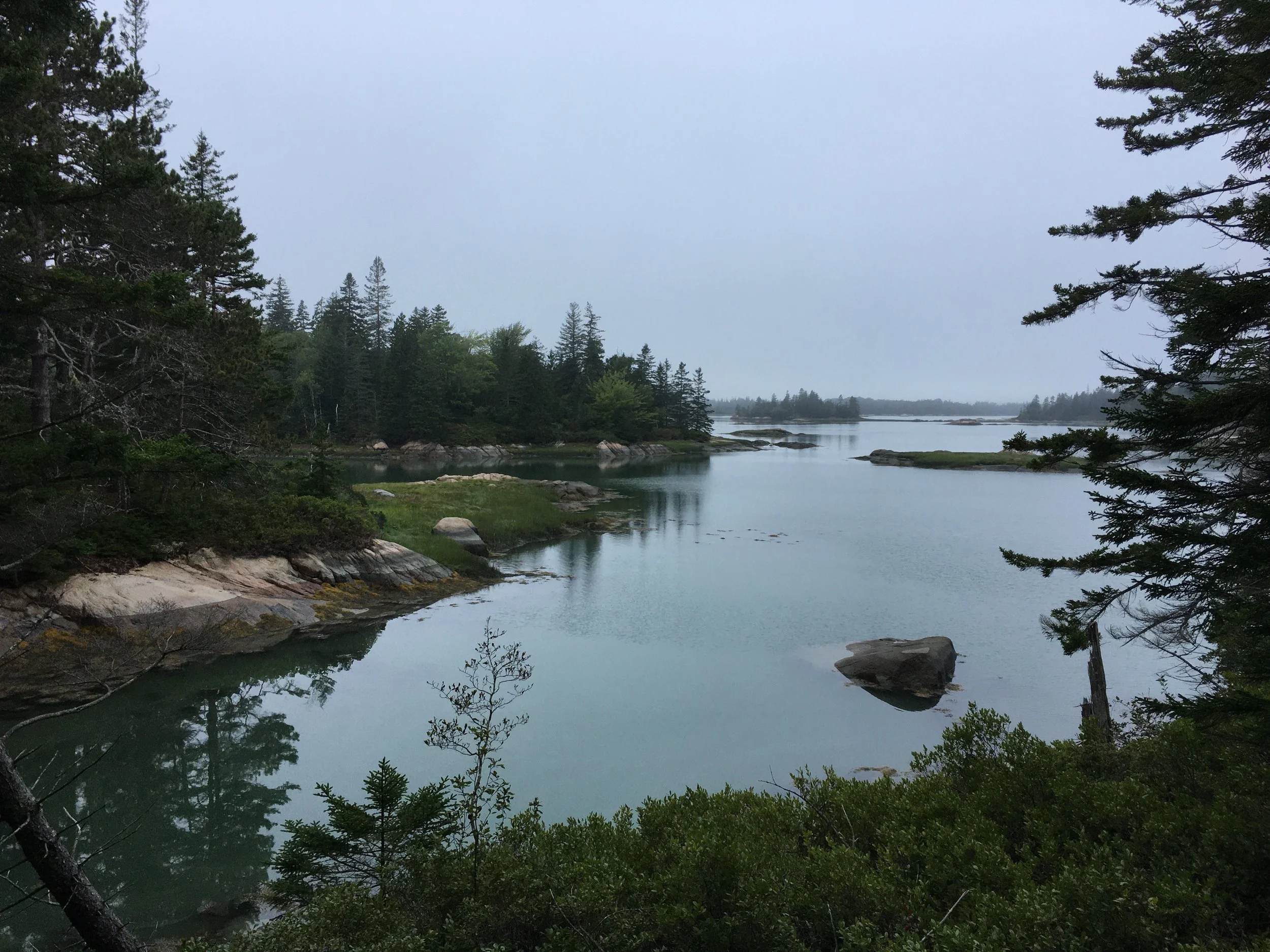
Trail: One mile loop, moderate difficulty. The Overlook trails allow visitors to see Vinalhaven granite in its natural, unquarried condition and expansive views from high above Mill River. Several benches allow one to pause and admire the shoreline vistas and watch for eagles and other seabirds. This trail system undulates in height from sea level to almost one hundred feet above it.
Round Pond Trail
Size: 46 acres.
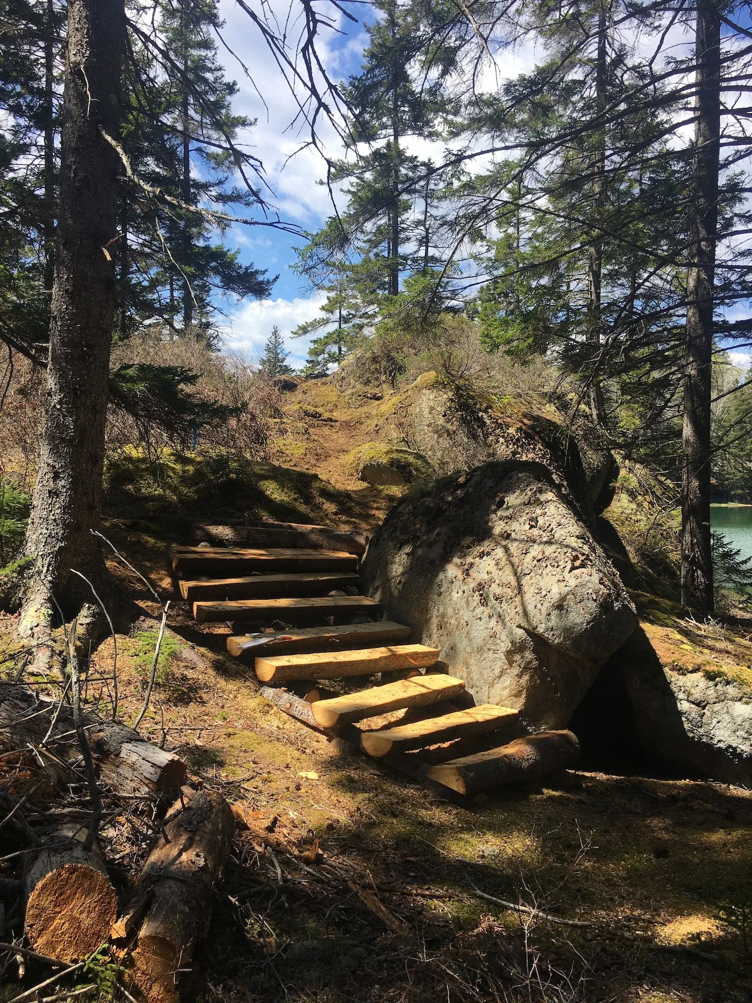
Trails: 1.2 miles (with loops), moderate difficulty. From the gravel parking lot adjacent to Round Pond, two new trails provide a quick and dramatic entry sequence for hikers. A short (1/10 mi.) trail follows a forgotten stretch of an old town road through mature spruces and granite outcrops to an open ledge where hikers can sit on a rustic bench and enjoy a scenic overlook of Round Pond. The grades are easy, and the footing is good enough for hikers of all ages and ability levels to enjoy. Partway up this trail, another short trail (1/10 mi.) branches off to the left. This trail takes hikers sharply uphill, around and through some massive granite ledges, and then levels off to connect with existing trails. Though the initial climb adds a bit more challenge to this one, the steep section is short enough that most hikers can easily reach the crest of the hill.
VLT was able to create these new trails thanks to the generosity of the Water District and a private landowner in letting us cross their properties. The trails may be short, but they offer some memorable glimpses of one of Vinalhaven’s most scenic spots.
Vinal Cove Connector
Trail: A 2022 addition that links Fish Hook and Overlook to Round Pond, allowing hikers to go more than 2.5 miles from Carrying Place Bridge to Round Pond, with parking facilities at either end.
Carrying Place Bridge
Size: 13 acres.
Trails: Trail to Winter Harbor shore, 0.3 miles round trip, easy. This is a popular access point for kayakers wishing to tour Mill River or Winter harbor. A short trail through mixed woods brings hikers to the shore of Winter harbor, while hikers with mobility issues may prefer an even shorter trail across the road, where a fifty-yard hard surfaced trail brings you to a bench overlooking Mill River.
Directions: From the ferry, go left on Sands Road for 0.4 miles, then right on Old Harbor Road for 0.3 miles, then bearing slightly left onto North Haven Road for 2.5 miles, at which point you reach the junction of North Haven Road and Calderwood's Neck Road. For Round Pond Trail, bear left at the intersection and park in the gravel pullout 0.2 miles on the right; for Fish Hook and Overlook trails, bear right at the intersection (Calderwood Neck Road) and park in the gravel lot 0.6 miles on left; for Carrying Place Bridge Preserve, go an additional 0.2 miles and park in the gravel lot on the right.
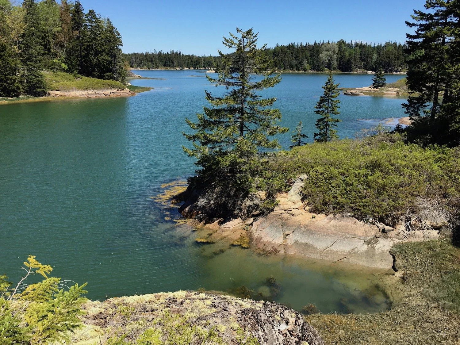
Overlook Trail, photo by Kerry Hardy.
History
In 2006, Vinalhaven Land Trust gratefully accepted Charles Sullivan's donation of a parcel of land on the northwest side of the Carrying Place Bridge. Subsequently, VLT purchased two adjacent lots, including the aptly named "Fish Hook" peninsula.
In 2013, VLT received a conservation easement on yet another nearby parcel of land, a 46-acre site just west of the Carrying Place Bridge, which allowed us to establish a hiking trail from Vinal Cove to Round Pond. This trail was completed in the summer of 2013, and visitors can enjoy more than a mile of hiking through mature spruce forests and over bare granite ledges.
In 2020, Charles Sullivan gifted VLT yet another property to the west of the Fish Hook trail, the Overlook parcel. New trails were established in 2021 and are now open for the public to enjoy. Thanks to a trail easement on a property between the Round Pond and Overlook trails, the Vinal Cove Connector was established in 2022, the final link in the 2.5 mile chain of trails between Round Pond and Carrying Place Bridge.
Together, these five properties comprise roughly a hundred acres and preserve half a mile of shoreline, characterized by bold granite ledges and forested hillsides that descend dramatically to the mud flats and salt marshes of the Mill River.
Lower Mill River forms a bookend to an existing preserve owned by Maine Coast Heritage Trust, Carrying Place Bridge Preserve, which is further protected by an easement held by VLT.
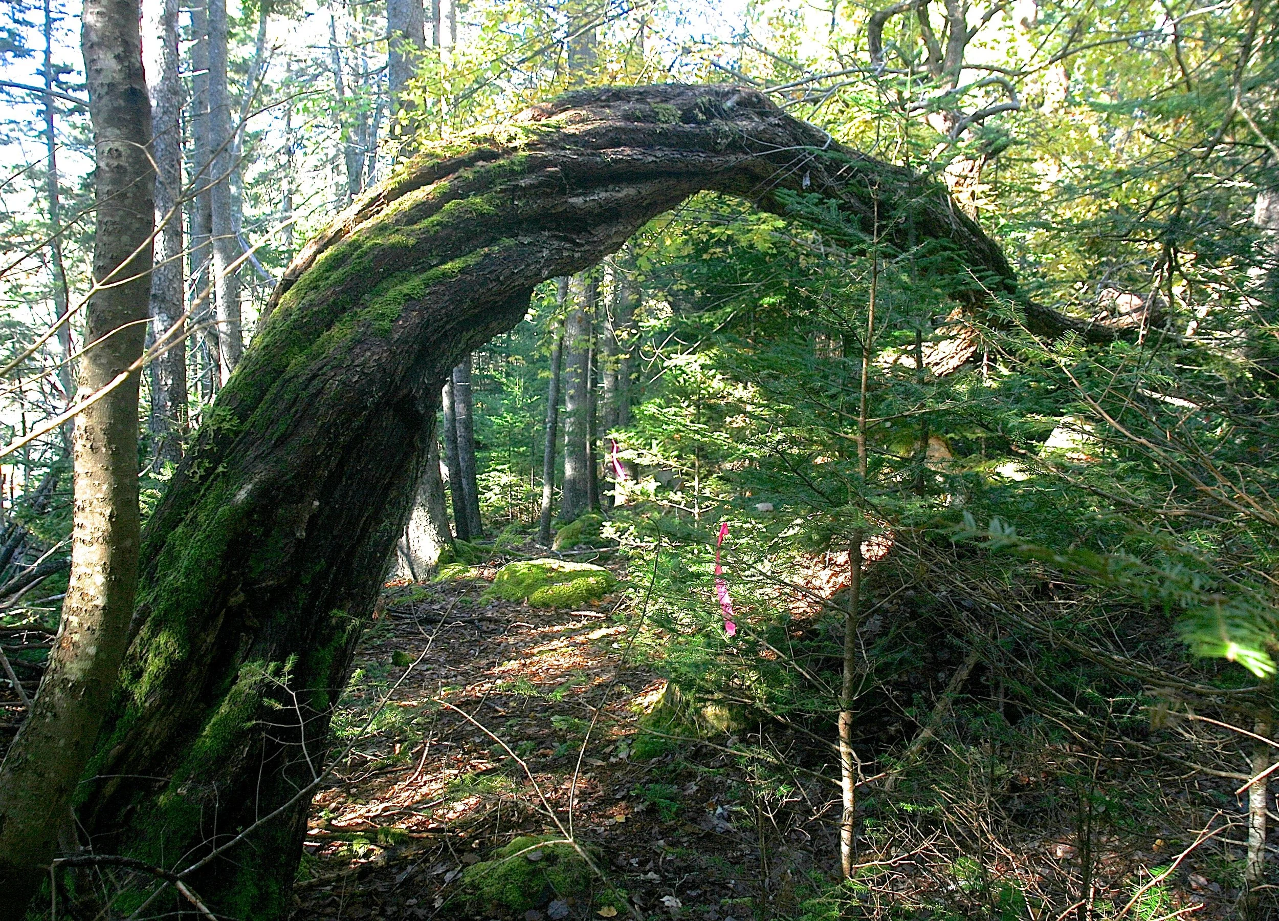
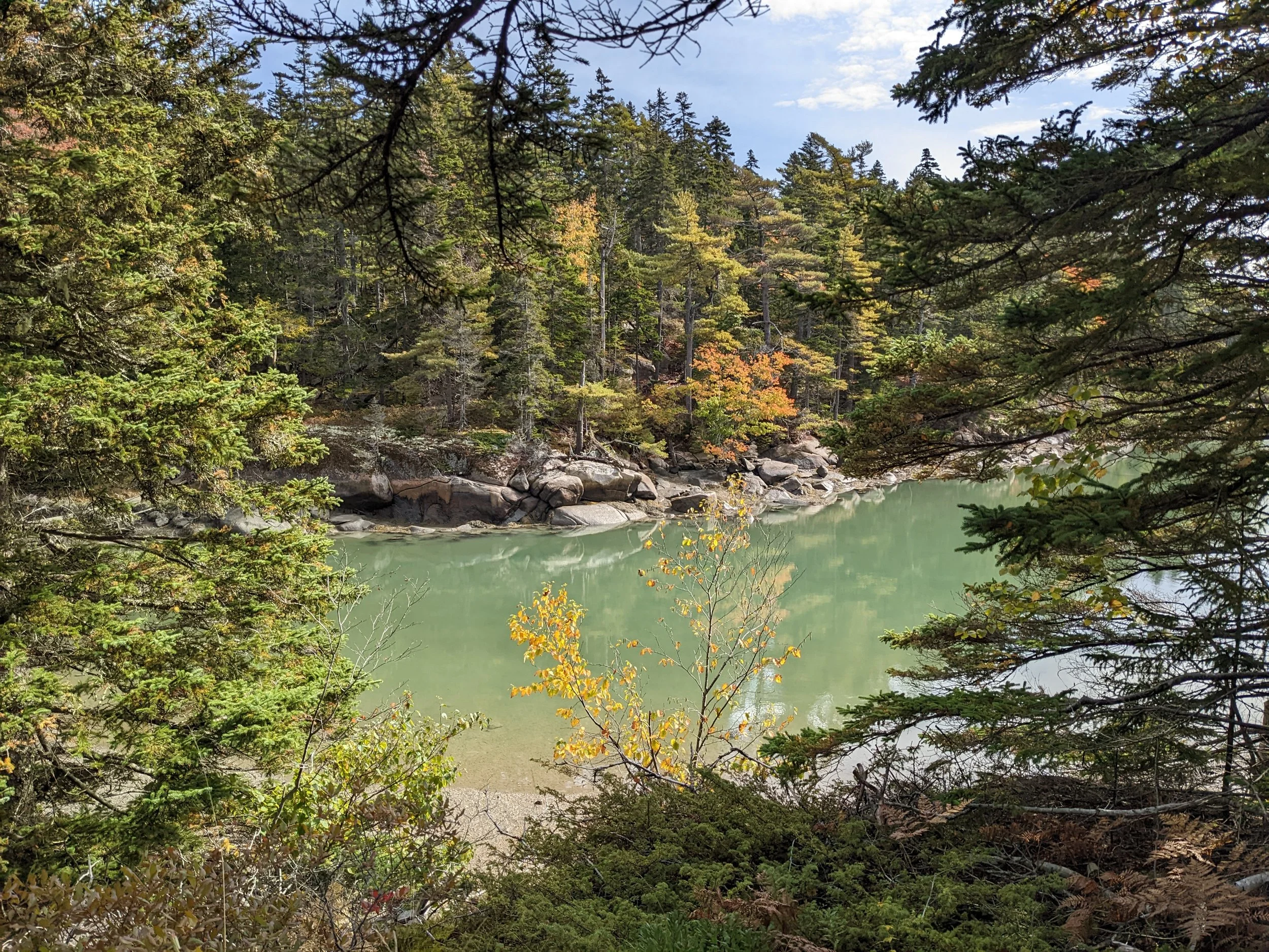
Arched maple at the Round Pond Trail, photo by Kerry Hardy.
Trails
Round Pond Trail: Excellent opportunities to see warblers and other forest songbirds, dramatic granite outcrops with pitch pine forests; just a few yards east of the Round Pond Trail you might catch a glimpse of a magnificent red spruce fully three feet in diameter. The two loops total 1.2 miles of trail are almost all shaded.
Fish Hook Trails: A short, shady trail, it passes by one of the largest eastern hemlocks on the island and through mixed forest to a mature grove of red pines atop Fish Hook, a steep-sided peninsula that juts into the Mill River. A great place to see eagles, ospreys, loons, kingfishers, and assorted wading birds; also offering excellent views of mussel beds and clam flats, tidal waterfall, and midsummer sunsets.
Overlook Trails: Adjacent to and just west of the Fish Hook trails, allows visitors to see Vinalhaven granite in its natural, unquarried condition. Massive ledge outcrops, with hardwood seeps filling the spaces between them, offer expansive views from high above Mill River. Notice some of the largest red spruce trees on the island, and several benches allow a pause and shoreline vistas. The loop trail, which starts at the Fish Hook parking lot, about one mile in length, undulates in height from sea level to almost a hundred feet above it. This new trail gives hikers a nice workout — with rewards of some fine views.
Vinal Cove Connector: From its beginning near Vinal Cove, the trail rises steadily through a series of shady ledges, with the land falling away dramatically to the left side. At the top of the hill, you’re 100’ above sea level, on mossy ledges under towering spruce trees. From here, the forest character changes sharply—the ground is nearly level, and young birch trees are on all sides of you, amid islands of huckleberries and bracken ferns. This is the evidence of a forest fire here roughly fifty years ago. A final 200 yards, mostly across open ledges, brings you to a fork in the trail—swing left to meander along the shoreline portion of Overlook, or go straight to cross Overlook quickly to reach Fish Hook. The trail is entirely on private property, intended only for hikers—there is no parking allowed at the trailhead or in the gravel driveway nearby, so please leave cars at one of the three designated parking areas for the preserves.